Mapping US health system capacity needs to care for COVID-19 patients
We are a volunteer open-source geospatial effort to map beds, ventilators, supplies, staff, and other resources needed to care for COVID-19 patients. If you collect or use such data, we can help you aggregate, analyze, or visualize it to better inform surge capacity planning and resourcing decisions.
Request data support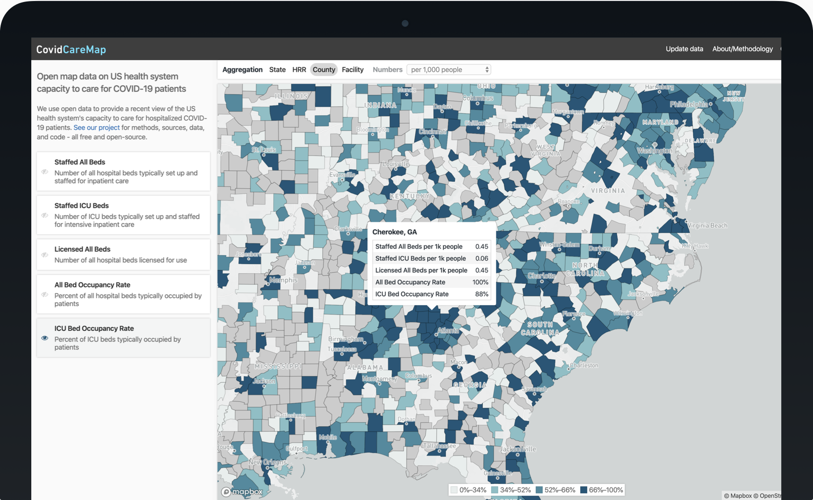
Visualizations
Maps, charts, analysis, and other visualizations about health system capacity. Don’t see what you’re looking for? Contact us and let us know what what you need from our team.
US Hospital Facility Bed Capacity Map
Open map data on all US hospitals’ bed capacity to care for COVID-19 patients by facility, county, hospital referral region, or state.
IHME COVID-19 Explorer
Explore the latest Institute for Health Metrics and Evaluation (IHME) COVID-19 projections through time by country and region.
Data
Open, analysis-ready datasets about health system capacity to care for COVID-19 patients, especially the critically ill. All methods, data processing notebooks, visualizations, and other source code are free and open-source.
Have more up to date data? Update data.
Hospital Bed Capacity
Why
Our healthcare system is at risk of being overwhelmed. How quickly and how many people are falling ill to COVID-19 at one time may exceed our ability to effectively care for everyone, especially at the ICU level.
We must #FlattenTheCurve to give our healthcare system more time to prepare for this surge of patients. Preparation means enough space, staff, supplies, and systems at the right places and times to meet patient needs. Through mapping and geospatial analytics, we provide situational awareness and foresight for health systems, policymakers, emergency managers, suppliers, and the public to plan and coordinate preparations between facilities, counties, states, or nationwide.

Team
We are a volunteer team of data scientists, engineers, designers, developers, communicators, healthcare experts, and more who have rallied together to support our healthcare providers' ability to care for every patient. Join us to help the helpers.